Many walkers who dream of being able to link the 2 seas via the mountains are familiar with it: the GR10 criss-crosses the Pyrenees chain from the Atlantic to the Mediterranean. This long-distance footpath takes hikers from lakes to peaks, from shepherds’ huts to refuges, from villages to unspoilt areas. Every bend in the path is a pleasant surprise. It can be done in its entirety or in stages. To do the whole thing, you’ll need between 1? and 2 months, depending on your pace. This trail was created not so long ago by two hiking enthusiasts: Francine and Jean Adisson.
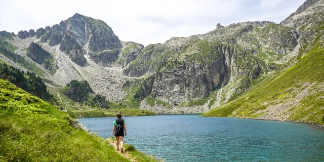
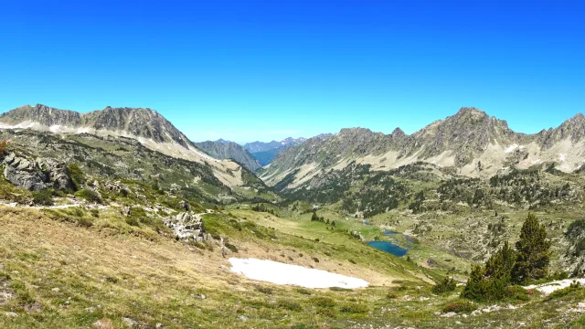
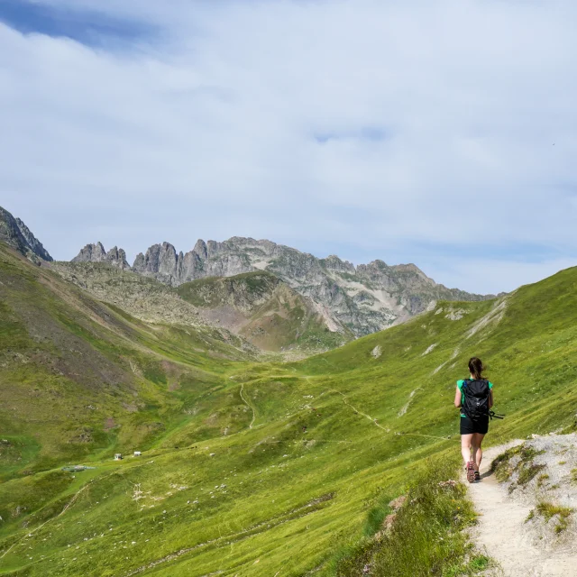
Hiking on the GR10, in the Néouvielle National Nature Reserve
|
Mythical trail
The GR10, crossing the Pyrenees
mythical
A legendary trail
Vignemale, Cauterets
|
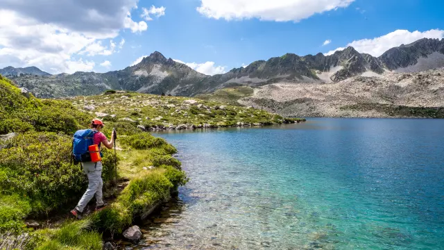
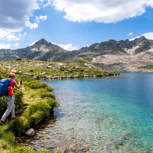
Excursion to Lake Ilhéou
|
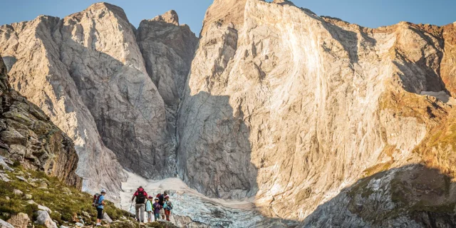
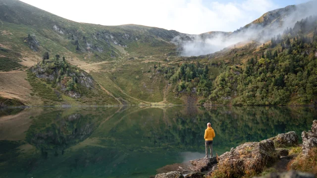
On the way to the Oulettes de Gaube refuge, facing the Vignemale
Because of the sometimes steep gradients, the GR10 is designed for trained hikers. Regular stopover gîtes and refuges offer the possibility of setting off with a relatively light rucksack.
Special features
Specific features of the GR10
in the Hautes-PyrénéesThe route through the Hautes-Pyrénées takes in 10 to 12 stages fromArrens-Marsous in the Val d’Azun to the granges d’Astau in the Haute-Garonne. Along the way, you’ll pass through some of the region’s most famous sites: Cauterets Pont d’Espagne, Cirque de Gavarnie (a UNESCO World Heritage site), the Néouvielle nature reserve… Stages that will delight lovers of wide open spaces, unspoilt landscapes and breathtaking panoramas.
The entire route is well signposted and easy to follow, leaving you time to concentrate on the scenery, the wind, the clouds, the flowers, the animals and the conversations with others. There are plenty of good, strategically placed refuges and gîtes.
stages
The stages of the GR10
from Valley to ValleyThe Val d’Azun
Gateway to the Hautes-Pyrénées
A verdant valley, a paradise for herds in the summer pastures, dotted with small villages with stone walls and slate roofs. Below, the village of Arrens-Marsous and its first architectural jewel: the golden chapel of Pouey Laün.
The path leads over the Col des Bordères to the pleasant banks of Lac d’Estaing, the Col d’Ilhéou and the lake of the same name. The perfect bucolic setting for a short siesta before resuming the walk to the spa village of Cauterets.
Lac Estaing A. Bonal
|
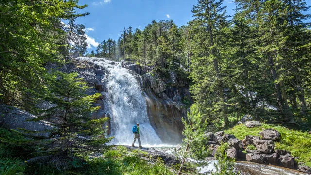
Walk along the waterfalls at Cauterets Pont d'Espagne
Cauterets-Pont d’Espagne
Land of waterfalls
From the village of Cauterets, the GR10 joins the Pays Toy. 2 routes to choose from:
- Route 1, the most direct: Col de Riou, Luz-Ardiden, village of Grust and Luz-Saint-Sauveur
- Route 2: towards the Pont d’Espagne and the Gaube valley, as far as Hourquette d’Ossoue where the path joins the valley of the same name, then Gavarnie and the Saugué plateau before descending to Luz-Saint-Sauveur.
From Luz-Saint-Sauveur – Pays Toy
The route passes through the villages of Viella, Viey and Sers, before reaching Barèges.
The Grand Tourmalet
From Barèges, the path joins the Vallée d’Aure.
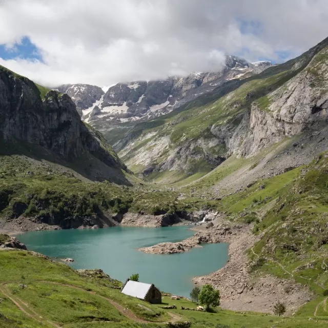
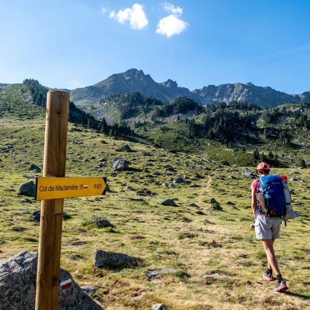
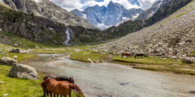
It crosses the Aygues-Cluses Valley, the Col de Madamète and Lac de l’Oule.
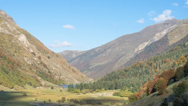
The Aure Valley
Once you arrive in the Aure Valley, the GR10 heads back towards the Louron Valley.
It passes through Azet and Couret de Latuhé.
The Louron Valley
This section is the last stage in the Hautes-Pyrénées before switching to the neighbouring Haute-Garonne department. The route takes you via Germ and the Pas de Couret or Couret d’Esquierry.
Hike with views of the mountains and Lake Aygues Cluses ©Luz-Saint-Sauveur Tourist Office
|
Walk across the Port Bielh lake ©François Laurens
|
Lake Bareilles, Louron
|
Must-see stops on the map
The GR10 guidebook
An essential tool for all hikers tempted by adventure, the topo-guide published by the FFRandonnée, ” GR10 – Pyrénées Centrales et le Tour du Val d’Azun ” (Ref 1091) offers a precise description of the route with extracts from IGN maps, accommodation and refreshment facilities.
FAQ
Frequently asked questions
Preparing for the GR10advice
Our tips for your walk
will love