- Distance: approx. 800 km
- Altitude difference: around 45,000 m
- Average duration: 41 days
- Optimum period: July to September (beware of snow at the start of the season)
- Level required: excellent physical and mental stamina, as well as solid experience of roaming in high mountains
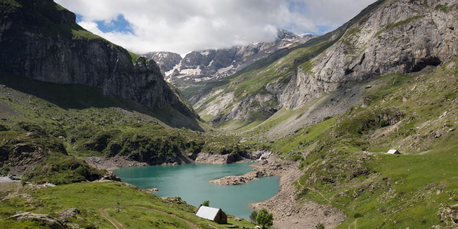
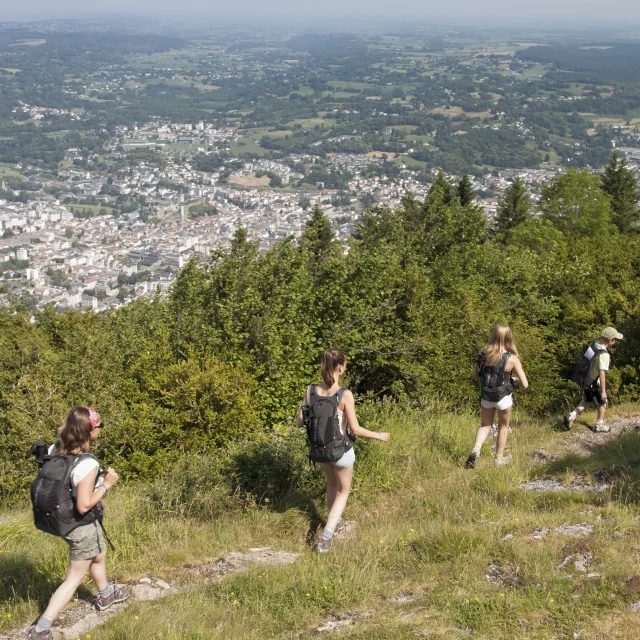
Hiking to the Cirque d'Estaubé, near Gavarnie
|
The Haute Route Pyrénéenne
the crossing that runs alongside the peakskey figures
A few key figures on HRP
stages
The HRP itinerary
In the Hautes-PyrénéesThe route enters the Hautes-Pyrénées after skirting the Pic du Midi d’Ossau and making an incursion on the Spanish side of the Pic Palas. It leaves via the port of Barroude before continuing eastwards into Aragon, then rejoins our département via the Soula refuge in the Louron valley.
Each step takes you further away from the civilised world. No more roads, no more villages, just stone, wind and immensity. The crisp air whips your face, your muscles burn as you climb, and climbing a pass becomes a personal conquest.
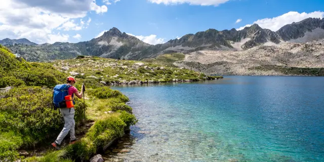
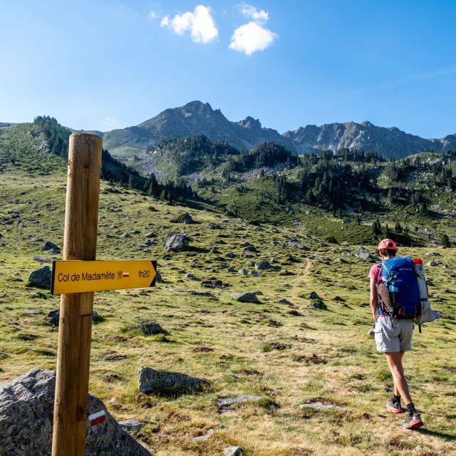
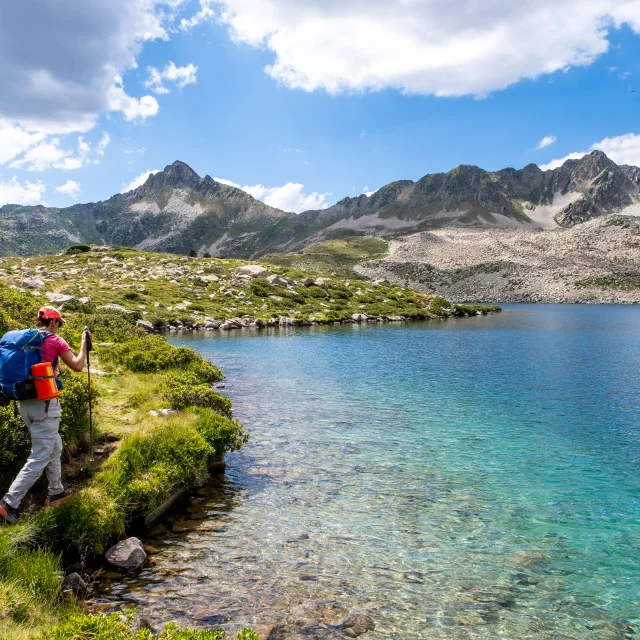
Well-equipped hiker at Port Bielh lake France, Vielle Aure, 2023-07-27. Illustration of a hike in the Neouvielle massif. Thanks to the opening of new refuges, this lakeside region of the central Pyrenees can be explored over a few days. A hiker on a path beside the Port Bielh lake with the Aygues Cluses peak and the Hourquette Nere in the background. Photograph by Francois Laurens / Hans Lucas.France, Vielle Aure, 2023-07-27. Illustration of a hike in the Neouvielle massif. Thanks to the opening of new refuges, this lakeside region of the central Pyrenees can be explored over a few days. A hiker on a path beside the Port Bielh lake, with the Pic d'Aygues Cluses and Hourquette Nere in the background. Photograph by Francois Laurens / Hans Lucas.
|
Le cirque d'Estaubé Gavarnie Lac Des Gloriettes At Vallees De Gavarnie Pierre Meyer
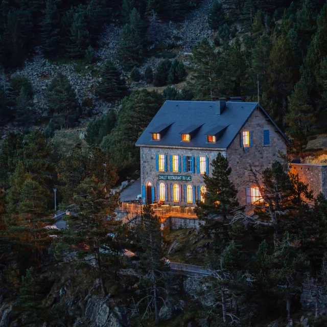
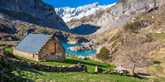
Hiking at the Ossoue dam near Gavarnie
stages
A few emblematic stages
across the PyreneesFrom the Larribet refuge to the Wallon-Marcadau refuge
From the Larribet refuge, perched in the upper Tech valley, the route plunges down to the Gave d’Arrens before a long ascent to the Col de Cambalès (2,706 m). Here, a spectacular traverse between lakes leads to the Wallon-Marcadau refuge.
📏 19 km | ⬆ 1,200 m D+ climb
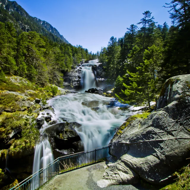
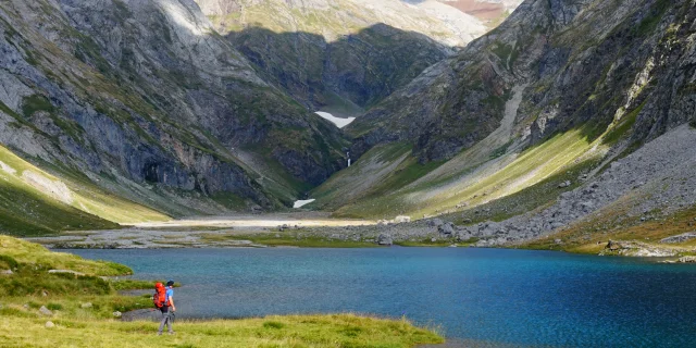
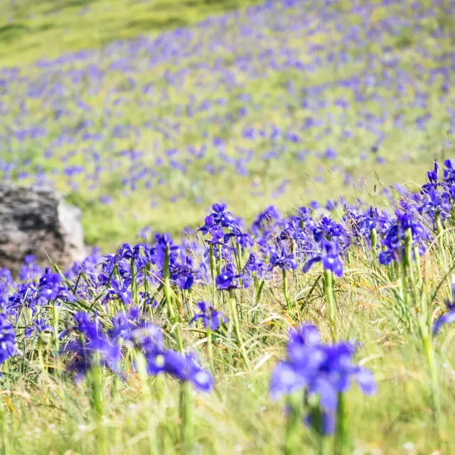
Lac du Tech, Val d'Azun
|
Facing the Vignemale, the highest peak in the French Pyrenees
From the Wallon-Marcadau refuge to the Bayssellance refuge
The route takes in the lake and the Col d’Arratille, skirting Spain briefly before descending to the Oulettes de Gaube refuge, at the foot of the north face of the Vignemale, the highest peak in the French Pyrenees. From the Col des Mulets, it follows the GR10 to the Bayssellance refuge, the highest guarded refuge in the French Pyrenees.
📏 13 km | ⬆ 1,350 m D+ climb
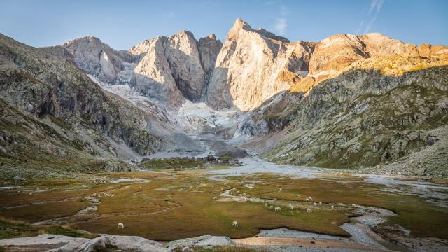
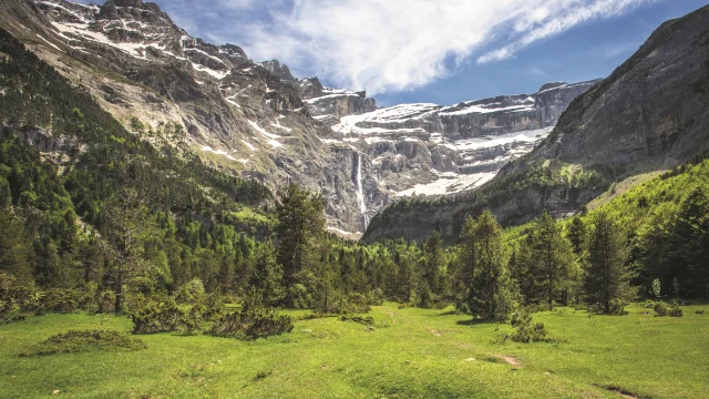
From the Bayssellance refuge to Gavarnie
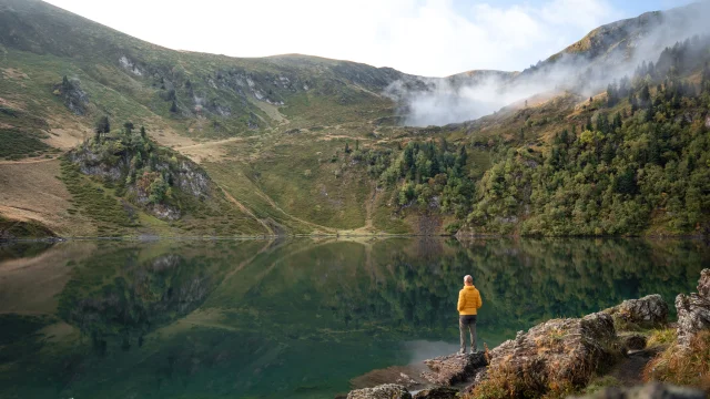
The Ossoue valley stretches out in mineral silence, broken only by the whistling of marmots. The descent seems endless, each bend revealing a new part of the landscape. Then, below, like a mirage, Gavarnie takes shape, tiny against the walls of its monumental UNESCO-listed cirque.
📏 18 km | ⬆ 150 m D+ (but 1,500 m D-!)
On the Courade plateau in the Cirque de Gavarnie ©HPTE - Pierre Meyer
|
Hiker in the Troumouse cirque Refugehpte Eric Martin Le Figaro Mag 10.09.2027 Hors Presse
From Gavarnie to Héas
From Gavarnie, the ascent to Hourquette d’Alans opens the way to a world of high mountains. After descending to the turquoise-hued Lac des Gloriettes, the route climbs to a balcony above the Cirque de Troumouse, offering breathtaking views of its imposing rock faces. Further on, the peaceful hamlet of Héas finally comes into view, nestling at the foot of the mountains.
📏 20 km | ⬆ 1,350 m D+ climb
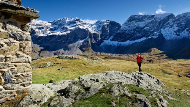
From Héas to Parzán
A demanding stage that begins with the ascent of the Aguila valley, where the effort is felt from the very first metres. After passing the Héas and Chermentas hillocks, the horizon opens up to the Barroude cirque, a mineral jewel suspended between sky and rock. Higher up, the port of Barroude marks the entrance to Spain. This is followed by a long descent where the terrain gradually changes, the vast screes giving way to more open valleys. The last few kilometres to Parzán, on the road, put the legs to the test after a day in the high mountains.
📏 32 km | ⬆ 1,650 m D+ climb
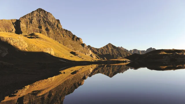
Reflet Du Pic De La Gela Dans Un Des Lacs De Barroude Hpte H Orriols
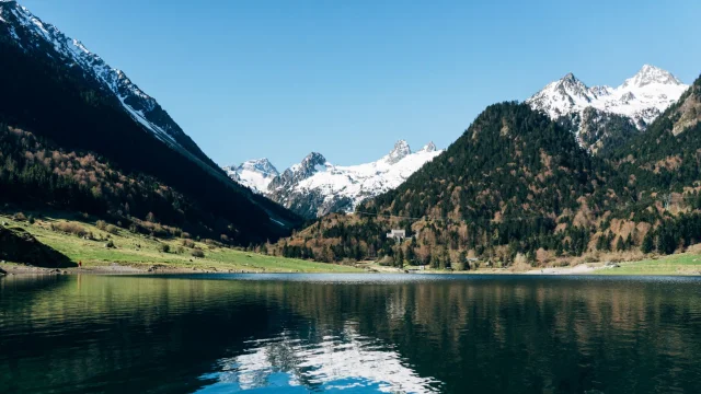
Lake Bareilles, Louron
|
From the Viados refuge to the Soula refuge
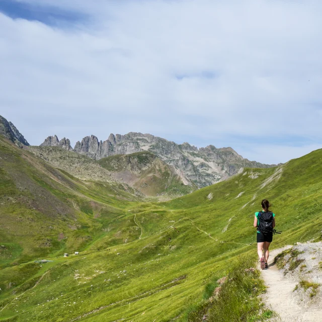
From the Viados refuge, the path climbs to the Aygues Tortes port (2,680 m), the last pass before returning to France. Up here, you can see the vast expanses of Aragon before turning towards the upper Louron valley. The descent follows rocky slopes and crosses meadows, skirting torrents and waterfalls. Further down, the Soula refuge comes into view, nestling in the hollow of the mountains, cradled by the roar of the rio Neste de Clarabide.
📏 13 km | ⬆ 950 m D+ climb
difficulties
The difficulties of the route
Orientation
The HRP alternates between marked paths (GR10, GR11) and unmarked sections where only a few cairns and natural landmarks indicate the way. Anticipation and precise navigation are essential for safe progress.
Technical and demanding terrain
Crumbling boulders, persistent snow, steep passages at over 2,500m…
The HRP requires seasoned mountain feet and good effort management.
Unpredictable weather
Thunderstorms erupting in a matter of minutes, sweltering heat in the valley bottoms, gusts of wind sweeping across the ridges… Even in summer, the mountains impose their own laws. Anticipation and adaptability are essential for safe progress.
itinerary
A high mountain itinerary
A Pyrenean heritage
Jean Bepmale was the first to describe this crossing in 1906, but his route differed greatly from the current one.
It wasn’t until 1968 that Georges Véron wrote the first topographical guide, which was regularly updated before its official publication in 1974.
Thus was born the HRP, a route that has become the stuff of legend for those who dare to challenge the Pyrenees at their very heart.
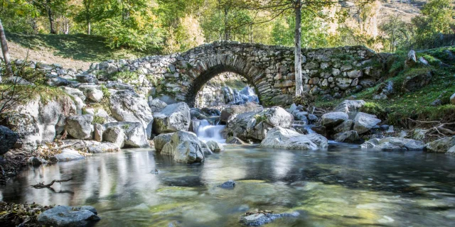
The Héas bridge Pierre Meyer 1
advice
Our tips for your walk
will love