©

Walk along the waterfalls at 
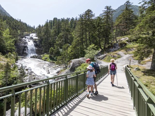
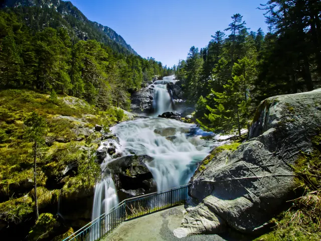
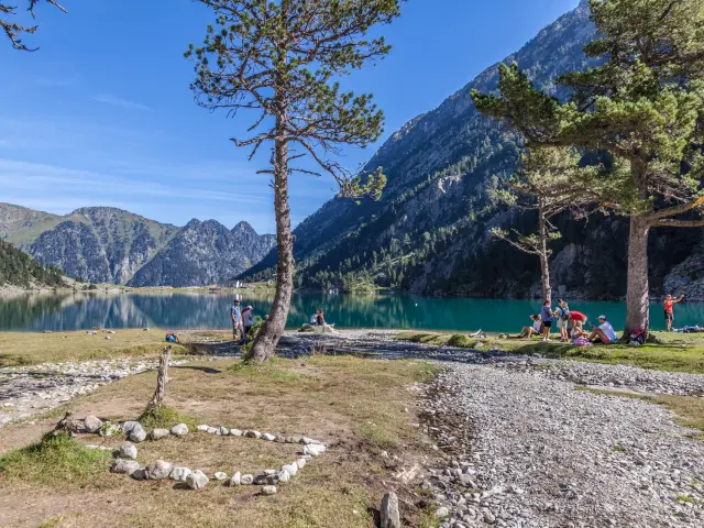
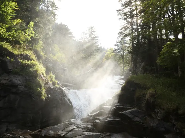
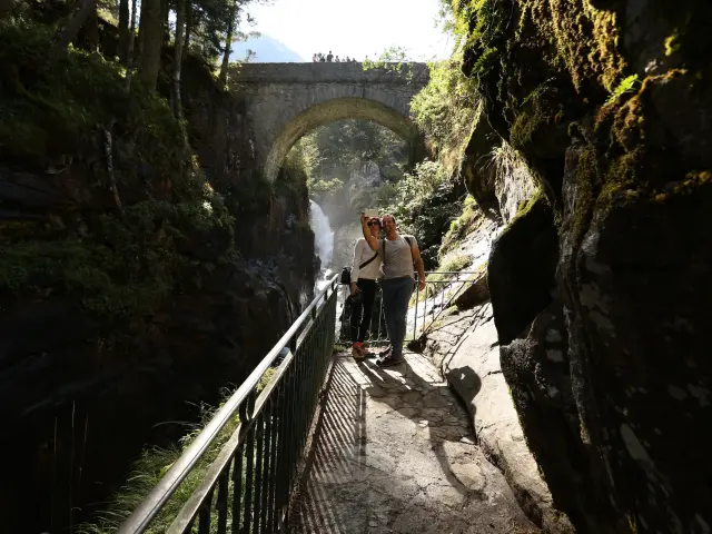
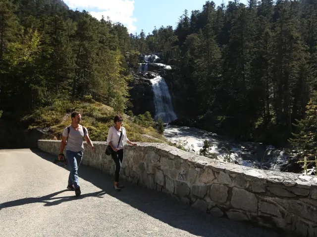
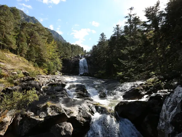
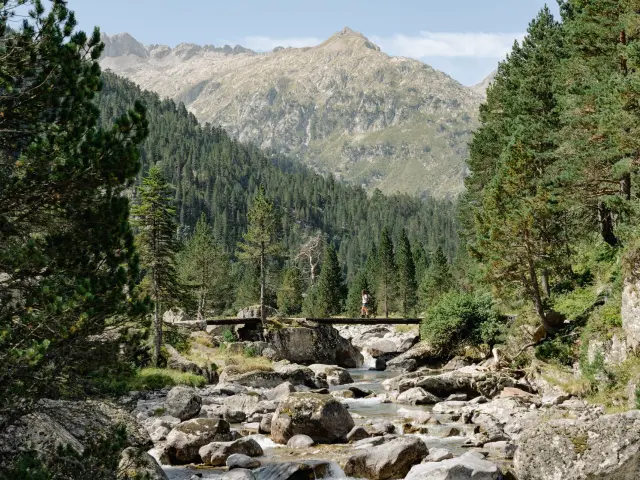
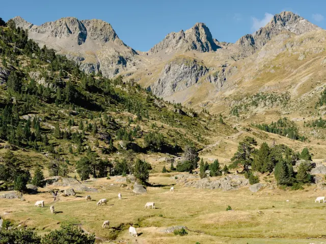
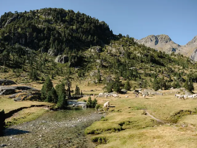
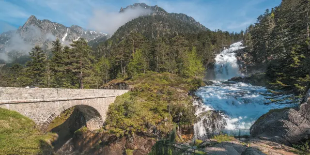
Cauterets Pont d'Espagne
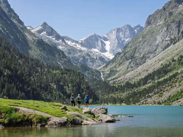
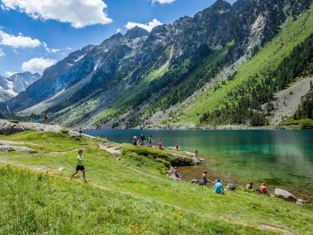
Hiking at the Pont d'Espagne

Cauterets

Above Cauterets, the Pont d’Espagne marks one of the most spectacular access points to the high Pyrenean mountains. Here, water leads the way, with waterfalls, a leaping river, high lakes, footbridges and pine trees clinging to the slopes. Very quickly, the place imposes its presence. Then the paths rise up towards other horizons: the Lac de Gaube, the Marcadau valley, or further still the high paths of the Vignemale. An ideal gateway for an easy stroll or a full day’s walk.

Waterfalls and lakes

A site where water leads the way

Waterfalls, lakes and high mountains

The water sets the tone right from the first steps. It leaps under the Pont d’Espagne, tumbling down the rocks, filling the air with a continuous roar and immediate freshness. All around, pine trees cling to the slopes, footbridges cross the river Gave and the mountain gradually closes in on a backdrop of rock, foam and forest. The site is immediately impressive. In just a few minutes, the waterfall is already imposing its force.

classic

A great classic

several ways in

At the Pont d’Espagne, everyone finds their own rhythm. Some come first for the roar of the water, the waterfall and the footbridges clinging to the rock. Others go as far as Lac de Gaube, a classic with easy access, or further into the Marcadau valley, where the space opens up and the pace lengthens. Higher still, the paths lead to the Vignemale routes.
Whether you’re looking for a short stroll, a family outing, a full day’s walk or a more sporting experience, the Pont d’ Espagne has the rare quality of lending itself to many different ways of experiencing the mountains.

The Pont d'Espagne and its waterfall

The most accessible route

Here, the effect of the place is almost immediate. As soon as you take your first steps, the Pont d’Espagne reveals its setting of rock, white water and pine trees hanging from the slope. The waterfall rumbles under the bridge, casting its freshness into the air and giving the walk an intensity that is rare for such a short route.

It’s the easiest way to enter the world of the place, without giving up the impression of a mountain. You come to see the waterfall, listen to thewater, smell the spray, then extend your walk a little on the nearby paths. It’s a great way to discover the site in a gentle way, before heading off to Lac de Gaube or the Marcadau valley, depending on the mood of the day.

Landmarks

Start: Pont d’Espagne site / main car park
Walking time: 5 minutes to the waterfall
Access: 7 km from Cauterets, by car or summer shuttle bus; car park, reception, lift ticket office, toilets and water points on site.

Lake Gaube

The great classic

Barely higher than the Pont d’Espagne, Lac de Gaube is one of the most famous images in the Pyrenees. On calm days, its deep, dark water reflects the silhouette of the Vignemale in a majestic face-off. There’s something obvious about the place: a large lake at altitude, a high mountain backdrop and the impression of entering the heart of the Pyrenees National Park.

The hike remains accessible, while retaining a true mountain character. From the Pont d’Espagne, the GR10 path first climbs a steep, stony section before reaching gentler slopes. Along the way, a short diversions takes you close to the Lac des Huats. The path then leads to Lac de Gaube, where you can easily take the time to stop, look around and simply enjoy the scenery.

On the way back, there’s a nice loop to vary the scenery. After crossing the bridge over the spillway, the path immediately turns right and takes just a few minutes to reach the arrival station for the Gaube chairlift. From here, a wide track winds its way down to the Pont d’Espagne.

Landmarks

Altitude: 1,725 m
Round trip distance: 6 km
Ascent: +250 m
Estimated walking time: 2 h 30
Start: Pont d’Espagne car park
Map: IGN Top 25 1647OT Vignemale

The waterfalls trail

From Cauterets to the Pont d'Espagne

Here,water accompanies the route from start to finish. From Cauterets, the waterfalls trail winds its way up the valley in a succession of rumbles, spray and gaps in the Gave. The route follows an almost continuous thread of water, between forest, polished rocks and footbridges, with that feeling of freshness that never really leaves the walker.

The first section leads as far as La Raillère, in an atmosphere of undergrowth and a discovery trail. Higher up, the waterfalls grow in size. A round trip brings you close to the spectacular Lutour waterfall, before returning to the main route. The climb then continues past the waterfalls of Escane Gat, Cerisey, Pouey Bacou, Pas de l’Ours and Boussès, to the finish under the Pont d’Espagne.

It’s a hike that appeals to those who enjoy walking for long stretches in a moving, sonorous and refreshing setting, with the Pont d’Espagne as the crowning glory. To lighten the day, you can also drive to La Raillère and leave from there.

Landmarks

Round trip distance: 11 km
Ascent: +550 m
Estimated walking time: 4 h
Start: Cauterets
Map: IGN Top 25 1748OT Vignemale

The Marcadau Valley

To extend your walk

From the Pont d’Espagne onwards, the Marcadau valley offers a different view of the mountains. Here, the cliffs become gentler, the river Gave accompanies your progress, the hooked pines become more widely spaced and you walk at a more leisurely pace. The water remains everywhere, but the scenery changes: less spectacular than the Pont d’Espagne waterfall, more open, more pastoral, with the impression of gradually entering a high valley filled with light.

The path climbs gradually, without abruptness, along the Gave. You walk between footbridges, clearings, pine trees and granite boulders, often with marmots on the lawns and, higher up, the possibility of spotting herds of chamois. It’s a great way to extend your day beyond the Pont d’Espagne, with the Wallon-Marcadau refuge on the horizon at an altitude of 1,865 m.

Information

One-way distance: 7.8 km
Ascent: +413 m
Estimated walking time: 2 h 30
Start: Pont d’Espagne
Finish: Wallon-Marcadau refuge (1,865 m)
Map: IGN Top 25 1647OT Vignemale

Le Petit Vignemale

For experienced walkers

At 3,032 metres, the Petit Vignemale is clearly in a different league. From the Pont d’Espagne, the day takes on a whole new dimension: long, mineral and demanding, but without the glacial and technical character of the Grand Vignemale. Its proximity to this great neighbouring summit gives the climb a particular intensity, facing one of the great walls of the Pyrenees.

The route begins like the one to Lac de Gaube, on the GR10. After an initial steep, stony climb, the path joins the lake, then skirts around its waters before continuing on to the Oulettes de Gaube refuge, set against the immense north face of the Vignemale. Above this, the path reaches Hourquette d’Ossoue, the highest point of the GR10, in an increasingly mineral world. The final climb to the summit follows a cairned path through the rocks. A short final ridge can be daunting for unaccustomed walkers, but getting to the top is well worth the effort.

Landmarks

Altitude: 3,032 m
Round trip distance: 24 km
Ascent: +1,550 m
Estimated walking time: 9 h
Start: Pont d’Espagne car park
Map: IGN Top 25 1748OT Vignemale

Before you leave

Just 7km from Cauterets, the Pont d’Espagne is easily reached by car or shuttle bus. From the village, it takes around 15 minutes to reach the site. On site, everything you need to organise your day is in place: car park at the entrance, reception, lift ticket office, toilets and water points. Access to the site itself is free; only the car park and lifts are chargeable.

The Pont d’Espagne shuttle bus links the site to the centre of Cauterets. It serves several stops, including the bus station, the town centre, La Raillère and Le Bois, before arriving at the Pont d’Espagne. Timetables vary according to the season and school holidays, so it’s best to check before you set off.

The Pont d’Espagne is in the heart of the Pyrenees National Park, in a protected environment that calls for vigilance and respect for the area. Dog regulations vary according to season and area. It’s best to check before setting off, especially if the route continues beyond the main site.